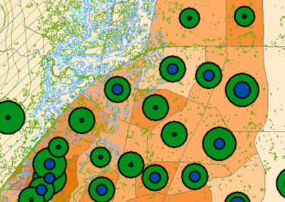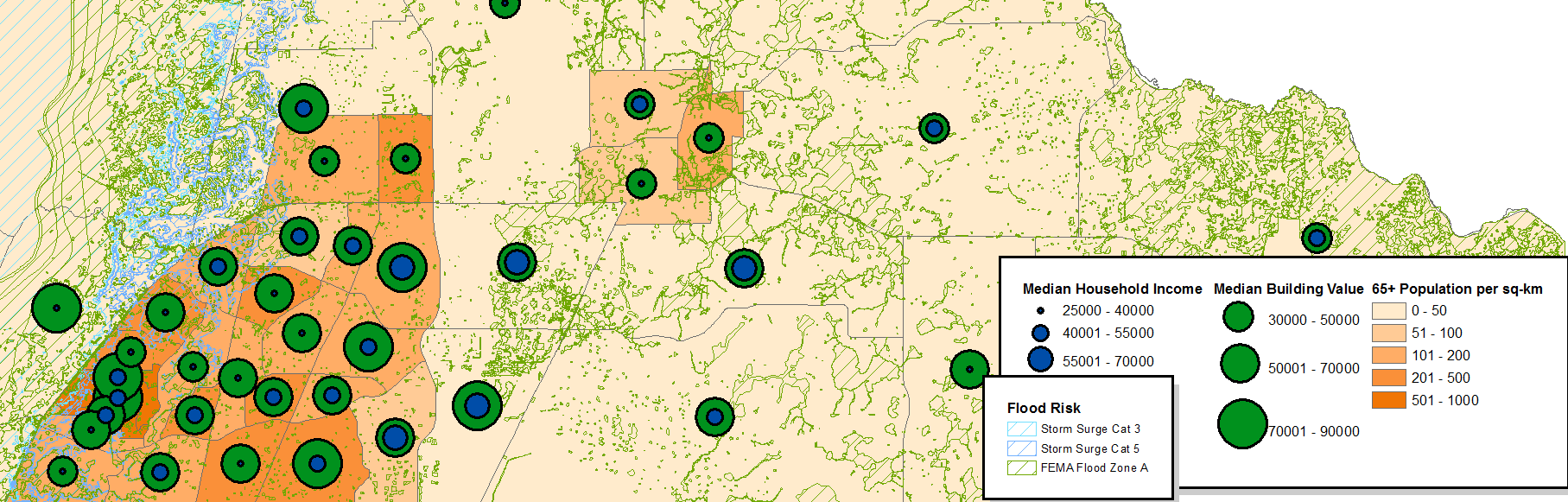
GIS Hazard Vulnerability Analysis
Florida Counties face natural hazards from storm flooding, fires, hurricane winds and storm surge, and sinkholes. A GIS approach to hazard vulnerability analysis helps identify potential impacts of natural hazards on vulnerable populations, property and natural resources.
Community vulnerability can be evaluated along multiple dimensions, including: Critical Facilities, Ecosystems, Economy, Coastal Resources, Water Resources, and Population. This type of study serves as a planning tool for communities exploring mitigation options and strategies for post-disaster redevelopment efforts.
Project Locations
Sumter County, Florida
Hernando County, Florida
Client/Partners
Calvin Giordano & Assoc
Services
Vulnerability Analysis, Mapping